


KC WD2 PCT214, Jackson County, Missouri
About
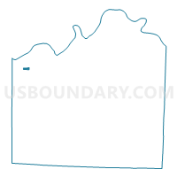
Outline

Summary
| Unique Area Identifier | 608133 |
| Name | KC WD2 PCT214 |
| County | Jackson County |
| State | Missouri |
| Area (square miles) | 0.27 |
| Land Area (square miles) | 0.27 |
| Water Area (square miles) | 0.00 |
| % of Land Area | 100.00 |
| % of Water Area | 0.00 |
| Latitude of the Internal Point | 39.08670810 |
| Longtitude of the Internal Point | -94.56072430 |
Maps


Graphs
Select a template below for downloading or customizing gragh for KC WD2 PCT214, Jackson County, Missouri


Neighbors
Neighoring Voting District (by Name) Neighboring Voting District on the Map
- KC WD1 PCT106, Jackson County, MO
- KC WD14 PCT1407, Jackson County, MO
- KC WD2 PCT204, Jackson County, MO
- KC WD2 PCT205, Jackson County, MO
- KC WD2 PCT209, Jackson County, MO
- KC WD2 PCT210, Jackson County, MO
- KC WD2 PCT215, Jackson County, MO
Top 10 Neighboring County Subdivision (by Population) Neighboring County Subdivision on the Map
Top 10 Neighboring Place (by Population) Neighboring Place on the Map
Top 10 Neighboring Unified School District (by Population) Neighboring Unified School District on the Map
Top 10 Neighboring State Legislative District Lower Chamber (by Population) Neighboring State Legislative District Lower Chamber on the Map
Top 10 Neighboring State Legislative District Upper Chamber (by Population) Neighboring State Legislative District Upper Chamber on the Map
Top 10 Neighboring 111th Congressional District (by Population) Neighboring 111th Congressional District on the Map
Top 10 Neighboring Census Tract (by Population) Neighboring Census Tract on the Map
- Census Tract 43, Jackson County, MO (2,168)
- Census Tract 161, Jackson County, MO (2,046)
- Census Tract 160, Jackson County, MO (1,840)
- Census Tract 166, Jackson County, MO (1,771)
- Census Tract 158, Jackson County, MO (1,485)
- Census Tract 162, Jackson County, MO (1,155)
- Census Tract 37, Jackson County, MO (1,008)